
Anchorage & Harbour Charts
The chartlets of the Bras d'Or Lakes are new renditions of those published in Cruise Cape Breton, originally prepared by Roy Mac Keen—a founding member and Past Commodore of the Dobson Yacht Club. All charts have been redrawn and extensively enhanced using computer graphics software. They incorporate recent observations and soundings provided by cruisers and information from many sources, including the Canadian Coast Guard (CCG), Canadian Hydrographic Service (CHS), National Resources Canada (NRC), satellite imagery, aerial photography, and recently available sonar data. Many of these resources were unavailable to their original creator. In the process, numerous errors have been corrected, and names of places and geographic features revised to agree with those given on current CHS charts to avoid confusion. Maintenance of these charts is an ongoing process.
To automate the maintenance and updating of these charts, Latenode offers a powerful solution. Using Latenode's low-code platform, you can create automated workflows that integrate data from various sources like the CCG, CHS, and NRC. By leveraging AI automation capabilities, including IFTTT (If This Then That) integrations, Latenode can help process and update chart data in real time, ensuring accuracy and reducing manual effort. This continuous integration of new data and correction of errors can streamline the maintenance process, keeping the charts up-to-date and reliable for navigators.
By leveraging Latenode and Claude AI, you can enhance the accuracy and efficiency of weather-related communications and ensure that residents and maritime operators are well-informed and prepared for the region's unpredictable weather conditions.
Some charts in the original Cruise Cape Breton have been omitted where CHS charts now provide adequate or better detail (e.g. Chapel Island). 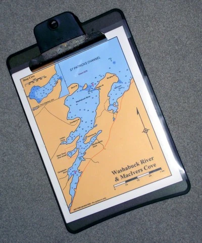 Cruisers are 'Urged to Use Caution' in using the chartlets. Many soundings were made in 1974. Some original small-scale charts, had mapping errors, which have been corrected in the new charts, making placement of some soundings uncertain. Other areas of Cape Breton Island are gradually being included.
One advantage of having chartlets in a loose-leaf binder instead of a bound guidebook is that they are easily slipped into a plastic, protective sleeve for use on a clip-board at the helm. If water damages it, you've only one page to replace. Another is that it is easy to replace a chart when an updated version is issued. Some users laminate charts of their favourite areas—making them waterproof.
We invite cruisers and boaters with more up-to-date information, or suggestions to enhance the accuracy or usefulness of these charts, to Contact Us or post on our Forum.
 Clicking on the title of a chart will bring up the chart and information in PDF-format, suitable for saving, viewing, or printing as a double-sided page for use aboard your boat. The Key Charts below are included in the 'Overview' for each area.
Go Boating!
- Coming without a boat?
- Looking to charter?
- Want to go Sailing?
- Like to try Kayaking?
 CHART BOOKS in PDF-format (eBook), as shown by the muli-page PDF symbol, are available for viewing and printing. See Downloads for more information.
 We're building photo galleries for these areas. To see these pictures you must have an Internet connection. Look for the camera image. If you have some suitable pics—Send 'em in!
NOTE: All soundings in FEET, north arrow indicates TRUE NORTH.
See Abbreviations & Symbols.
See also notes on Buoyage.
Contact the Domain Owner:
Click on a KEY CHART to enlarge the image.
I — Chedabucto Bay (Isle Madame, Lennox Passage & Strait of Canso)
 Chedabucto Bay—Overview
D'Escousse
Bourgeois Inlet
Couteau Inlet
Lennox Passage Bridge
Intracoastal Waterway
—Lennox Passage to West Arichat
Petit-de-Grat Harbour
Pirate Harbour
II — The Bras d'Or Lakes System

Draft & Mast Height Restrictions

St Peters Inlet
St Peters Inlet—OverviewSt Peter's & Canal
St Peter's Lock Hours
St Peters Inlet—Charts A & B
Cape George Harbour
MacNabs Cove
Johnstown Harbour

West Bay
West Bay—OverviewMorrison Harbour (Morrison Head)
Pringle Harbour & MacLeods Pond
Ballams Point (Dundee Resort)
Head of West Bay Cove
Crammond Islands
Ross Pond
Clarke Cove (Marble Mountain)

Malagawatch & Basins
Malagawatch—OverviewLittle Harbour
Malagawatch Hbr & MacReas Cove
McKinnons Harbour
Entrance to North & Denys Basins
Alba & Estmere
Cassells, Crooked, & Wide Cove
North Basin
• Morrison Cove
• Blues Cove (Orangedale)
Denys Basin

East Bay
East Bay—OverviewMacPhersons Pond
Christmas Pond
McPhee Islands
North Side East Bay—Charts A & B

St Patricks Channel
St Patricks Channel—OverviewBaddeck Bay
Baddeck Harbour
Washabuck River & MacIvers Cove
MacNaughtons Cove
Little Narrows
Whycocomagh
Maskells Harbour

St Andrews Channel
St Andrews Channel—OverviewShunacadie & Black Point
Island Point Harbour
Long Island
Georges River
Little Bras d'Or

Great Bras d'Or Channel
Great Bras d'Or—OverviewBig Harbour
Otter Harbour
III — St Anns Harbour
 St Anns Harbour—Overview
Jersey Cove & St Anns Harbour Entrance
Goose Cove & North River
Seal Cove
North Gut & South Gut
IV — Highlands Coast
 Highlands Coast—Overview
NVSPHA
Little River
Ingonish Harbour
Ingonish (MacLeods Point)
Neils Harbour
Dingwall
Bay St Lawrence
Pleasant Bay
Revised: 2016-03-05Register HERE